Shiningintl provides the whole counter-drone systems(C-UAS) solution: GNSS navigation spoofing solution, now there are many modules available, this article will show how to create a full band anti drone system with Shiningintl latest navigation spoofing solution products.
In order to create a counter-drone system to cover all navigation systems, we have to know all the available navigation GNSS systems in the world now, till now , there are 6 navigation systems available through out the world: Beidou , GPS, Galileo,GLONASS,NavIC and QZSS. The detail systems summary as below table:
| System (Country/Region) | Primary Frequency Bands (Civilian Use) | Frequency Range (Approx.) | Key Characteristics |
| GPS(USA) | L1 C/A, L2C, L5 | 1176.45 MHz (L5), 1227.60 MHz (L2), 1575.42 MHz (L1) | Gold standard; L5 is modern, high-performance. |
| GLONASS(Russia) | L1OF, L2OF, L3OC, L5 (new) | ~1602 MHz (L1), ~1246 MHz (L2), 1202.025 MHz (L3), 1176.45 MHz (L5) | Uses FDMA on L1/L2; modernizing to CDMA like GPS. |
| Galileo(EU) | E1, E5a, E5b, E6 | 1176.45 MHz (E5a), 1207.14 MHz (E5b), 1278.75 MHz (E6), 1575.42 MHz (E1) | Fully civilian, interoperable with GPS L1 & L5. |
| BeiDou (China) | B1I, B1C, B2a, B2b, B3I | 1176.45 MHz (B2a), 1207.14 MHz (B2b), 1268.52 MHz (B3I), 1561.098 MHz (B1I), 1575.42 MHz (B1C) | Hybrid constellation; B1C/B2a match GPS L1/L5. |
| NavIC(India) | L5, S | 1176.45 MHz (L5), 2492.028 MHz (S) | Regional system; unique S-band for better ionospheric correction. |
| QZSS(Japan) | L1 C/A, L2C, L5, L6 (LEX) | 1176.45 MHz (L5), 1227.60 MHz (L2), 1278.75 MHz (L6), 1575.42 MHz (L1) | GPS complement over Japan/Asia; L6 provides centimeter-level service. |
Detailed Breakdown by System
These systems operate in the L-band (1.2 GHz) of the radio spectrum, which offers a good balance between antenna size, signal penetration through the atmosphere, and data bandwidth.
1. GPS (Global Positioning System – USA)
GPS uses Code Division Multiple Access (CDMA)on three primary frequencies:
- L1 (1575.42 MHz):Carries the legacyC/A (Coarse/Acquisition) code for civilian use and the encrypted P(Y) code for military. It’s the most common signal.
- L2 (1227.60 MHz): Originally military-only, now broadcasts the civilian-accessible L2C signal, which improves accuracy and reliability.
- L5 (1176.45 MHz): A modern, high-power “safety-of-life” signal for aviation and critical applications. It is more resistant to interference and enables very high accuracy.
2. GLONASS (Global Navigation Satellite System – Russia)
GLONASS originally used Frequency Division Multiple Access (FDMA), where each satellite transmits on a slightly different frequency.
- L1 Band (~1602 MHz): Carries the standard-precision civil signal (L1OF).
- L2 Band (~1246 MHz): Carries another civil signal (L2OF).
- Modernization: New GLONASS-K and M satellites now also transmit CDMA signals on new frequencies (L3OC at 1202.025 MHz and L5 at 1176.45 MHz) for better interoperability with GPS and Galileo.
3. Galileo (European Union)
Galileo is a fully civil system designed to be interoperable with GPS. All signals use CDMA.
- E1 (1575.42 MHz): Shares the same center frequency as GPS L1 for easy receiver design.
- E5 (1191.795 MHz):A wideband signal split into two sub-bands:
- E5a (1176.45 MHz):Matches GPS L5.
- E5b (1207.14 MHz):Unique to Galileo, used for commercial and safety-of-life services.
- E6 (1278.75 MHz): Used for a high-accuracy commercial service (encrypted).
4. BeiDou (BDS – China)
BeiDou is a hybrid constellation (GEO, MEO, IGSO). It broadcasts signals compatible with other systems.
- B1I (1561.098 MHz):Legacy civil signal.
- B1C (1575.42 MHz):Modern signal on the GPS L1/Galileo E1 frequency.
- B2a (1176.45 MHz):Modern signal on the GPS L5/Galileo E5a frequency.
- B3I (1268.52 MHz):Used mainly for regional (China) and security services.
5. NavIC (India)
- :Operates in L5 (1176.45 MHz) and a unique S-band (2492.028 MHz). The S-band signal is less affected by the ionosphere, which is advantageous in the tropical region.
6. QZSS (Japan)
- Designed to augment GPS over Japan and Asia. It transmits signals identical to GPS L1 C/A, L2C, and L5, plus an additional L6 (1278.75 MHz) signal for centimeter-level augmentation services.
so sum up the available navigation systems in the world, the anti-drone system to cover all the navigation systems in the world must cover all these 6 navigation systems.
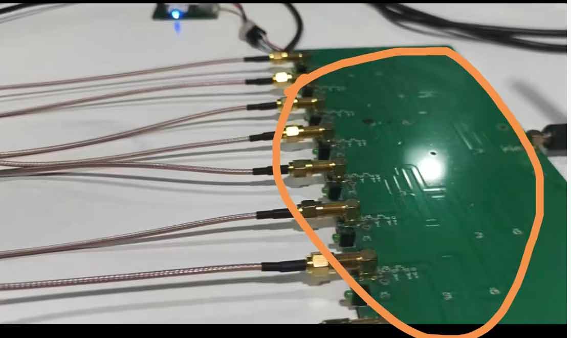
Shiningintl 22 band anti-drone GNSS spoofing module is the best choice to create the full anti-drone system. here is the bands that covered by this shiningintl 22 bands spoofing board.
| System | Signal frequency band | Center frequency (MHz) | Channel number |
| BDS | B1I | 1561.098 | 1 |
| B1C | 1575.42 | 2 | |
| B2I | 1207.14 | 3 | |
| B2a | 1176.45 | 4 | |
| B2b | 1207.14 | 5 | |
| B3I | 1268.52 | 6 | |
| GPS | L1 C/A | 1575.42 | 7 |
| L1C | 1575.42 | 8 | |
| L2 | 1227.60 | 9 | |
| L5 | 1176.45 | 10 | |
| GALILEO | E1B | 1575.42 | 11 |
| E1C | 1575.42 | 12 | |
| E5a | 1176.45 | 13 | |
| E5b | 1207.14 | 14 | |
| E6C | 1278.75 | 15 | |
| GLONASS | L1 (G1) | 1602 + k×0.5625 | 16 |
| L2 (G2) | 1246 + k×0.4375 | 17 | |
| L3 (G3) | 1202.025 | 18 | |
| QZSS | L1C/A | 1575.42 | 19 |
| L1C | 1575.42 | 20 | |
| L5 | 1176.45 | 21 | |
| NavIC | L5 | 1176.45 | 22 |
Shiningintl 22 bands counter-drone module has a very compact design, we provide a very precise combiner board to integrate all the bands antenna into 1 antenna, the antenna can cover all bands on 1.2G and1.6G, shown as below picture.